blah blah blah
Frenchs Ledge
Length: 1.2 miles out-and-backDifficulty (click for info): Beginner
Elevation Gain: 190 feet
Rating (click for info): 7/10
Elevation: 1371'
Prominence: 517'
Driving Directions:
Trailhead and parking area are on Columbus Jordan Road in Plainfield, NH. From Rt. 120, 8.0 miles south of Rt. 4 at the circle in Lebanon and 13.1 miles north of Rt. 103 in the center of Claremont, turn northwest at a four-way in the center of Plainfield onto Main Street. Drive 1.0 mile and turn left across the covered bridge onto Colby Hill Road. Drive 0.8 miles up the road, which soon turns to dirt, and take a left onto Columbus Jordan Road. Continue another 1.0 mile and look for the trailhead pull-offs on both sides of the road, just after the road passes through the second open field, and right after a driveway on the right. The trail starts on the left side. Click here for a Google map.
Trail map
About the Hike:
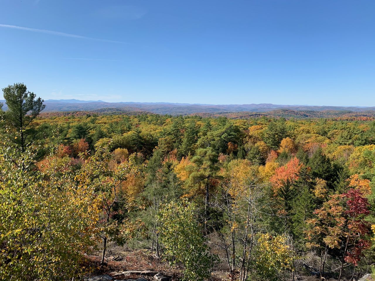
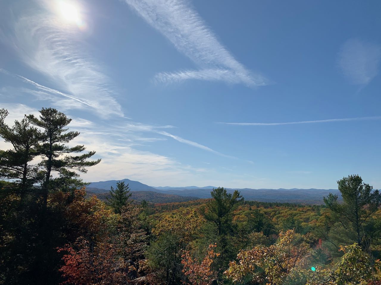
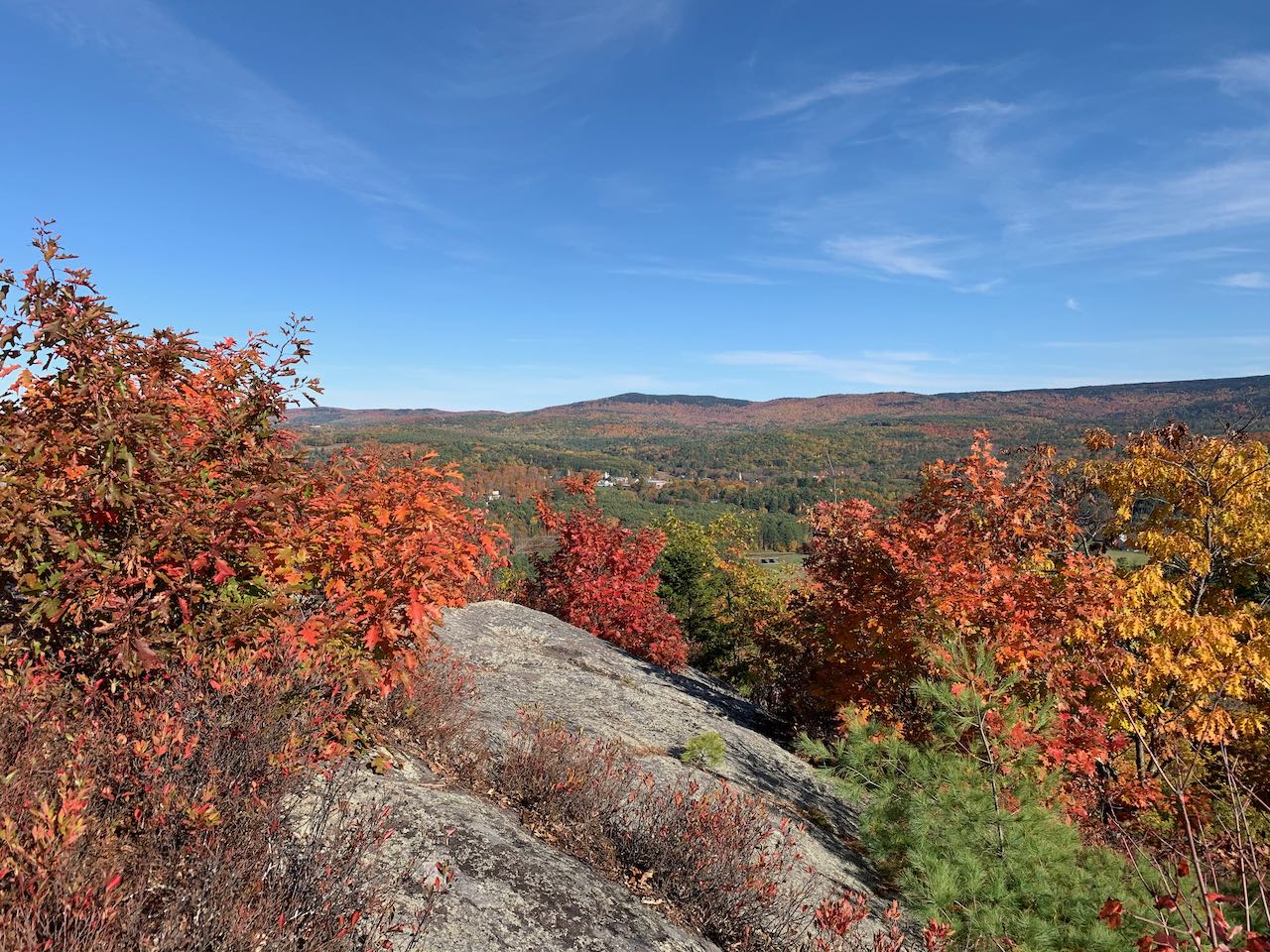
The brief adventure to Frenchs Ledge has all the ingredients of a quintessential "NH Family Hike". It's located in a quaint town in a region not known for hiking and has no notoriety itself, being a prime example of the cliched "hidden gem". The hike is a mostly gentle walk of just over a mile round trip, with one steep segment to get to the top. And the summit, merely sub-1400' in elevation, offers a stunning 360-degree view of big mountains and vast plains. The ratio of reward to effort is tremendous, and it has possibly the greatest view from a summit that low you'll find anywhere.
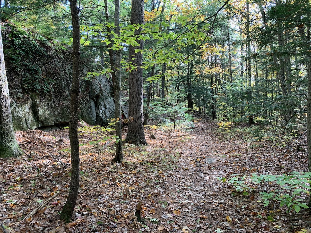
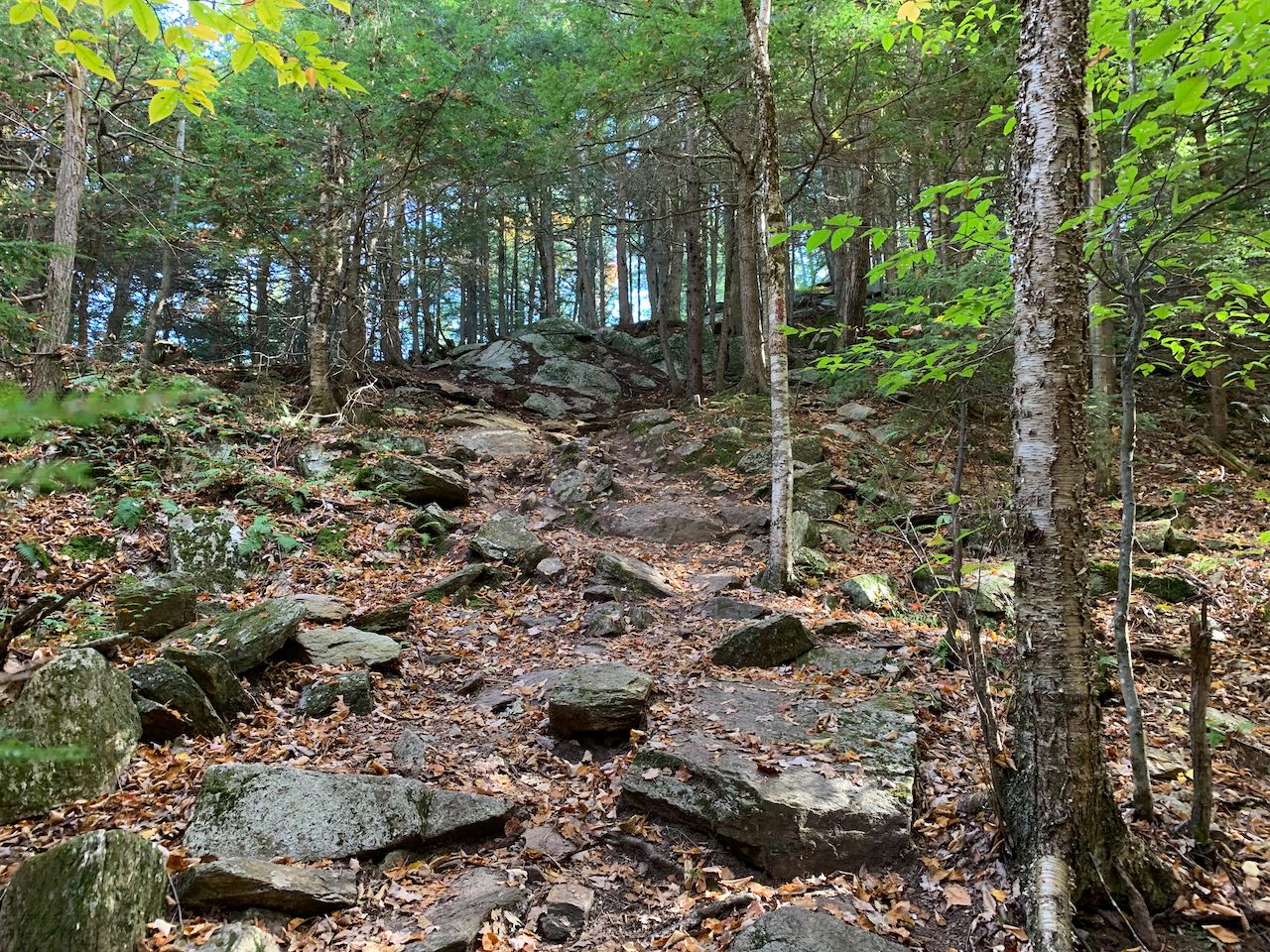
Head into the woods on the Blue Trail, soon crossing an old woods road after 0.15 miles. The path meanders casually through the woods, passing beside an embedded ledge and climbing up to a little rocky knob underneath the tree canopy after another 0.2 miles. It then dips down and runs 0.1 miles to an intersection, where French's Ledges Trail comes in from the left. Turn right and follow its red blazes as it remains level for a short way, then ascends the sharp dome of the peak over roots and rocks. A steep climb lifts you up onto the bare rock of the pinnacle, and you arrive at the summit in just 0.1 miles from the junction.
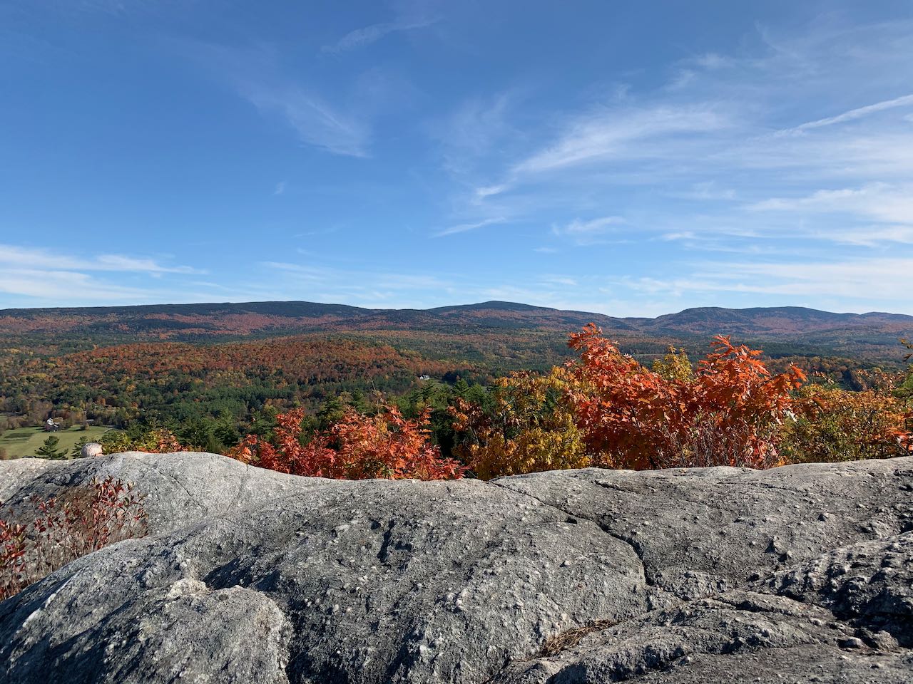
Although limited in area, the rocky top invites wandering around to take in all the different perspectives. The most striking view is to the southeast of the Croydon Mountain ridge, a monumental north to south string of mountains located in the Corbin Park, a vast private game reserve with an elite membership and reportedly exotic animals. A fire tower crowns the highest point, Croydon Peak (also the highest point in Sullivan County), which is close enough to be seen from here. To the northeast, behind some nearby low hills, are the White Mountains, with Mt. Moosilauke most prominent in front. The entire western side of the view stretches across Vermont, with pastureland and distant mountains. The long chain of the Green Mountains lines up across the horizon. Killington Peak is a particularly noticeable feature in the middle. The broad, bulky Mt. Ascutney is the biggest mountain nearby, off to the southwest. A stand of trees impedes a small section of the view to the south, but the view is essentially all the way around.
Printable directions page